


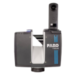
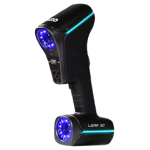
FARO® Blink
Imaging Laser Scanner
FARO Blink brings reality capture to everyone, combining intuitive workflows and stunning visuals with powerful performance—delivering professional-grade results quickly and effortlessly, right from the job site.
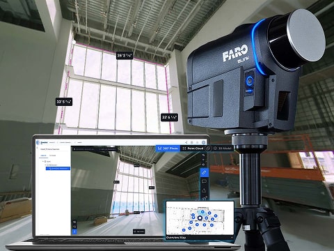
From site to insights, FARO Blink is a powerful reality capture solution built for simplicity and accessibility. It delivers high-quality visualization and automated workflows to designers, builders, surveyors, operators, and public safety professionals—empowering teams to capture, view, and share data effortlessly, no matter their experience level. With Blink, anyone can take full control of on-site reality capture and streamline the path from field to final delivery.
In a Blink, Progress is Captured
Blink offers a seamless and intuitive data capture experience through guided scanning and real-time feedback. Designed for simplicity and accessibility, Blink empowers users of all levels to capture the data they need—from initial concept to final delivery—with minimal onboarding required.
In a Blink, Data Becomes Insight
Blink simplifies the reality capture process, making it accessible to all. With automated scan processing and registration, users can quickly transform raw data into actionable insights. The platform also enables the extraction of orthophotos, streamlining analysis and reporting.
In a Blink, Decisions Are Empowered
Collaborate remotely and in real time on a digital jobsite via the FARO Sphere® XG cloud. Blink delivers professional-grade results with visually compelling outputs and highly accurate point clouds—equipping stakeholders with the reliable data they need for confident decision-making.
In a Blink, Reality is Captured
Blink makes reality capture as effortless as taking a photo. With just a push of a button, users can quickly capture, review, and share scans—enabling fast, effective progress tracking directly on the jobsite.
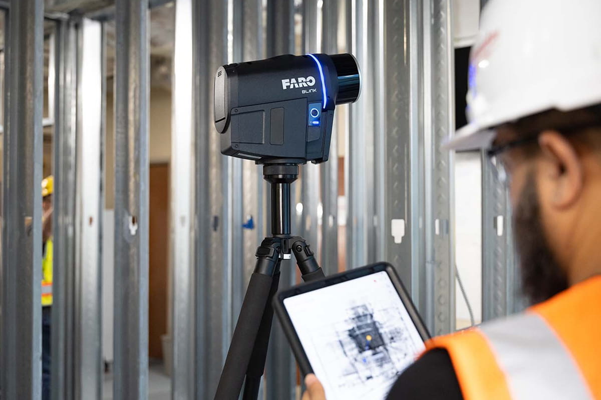
Guided Scanning with Real-Time Feedback
Blink features an intelligent, user-friendly interface that provides real-time guidance during scanning. Its integrated light indicator notifies users if they stray too far from optimal positions, ensuring high-quality results and simplified registration. This intuitive scanning process is designed to make laser scanning accessible to everyone—from first-time users to seasoned professionals.
Features
Below, you will find the main features of the product.
Imaging Laser Scanner Accuracy
Experience exceptional visual clarity, backed by precision point cloud data. Blink delivers up to 4 mm accuracy combined with high-resolution, 50-megapixel imagery for professional-grade results.
Sphere XG Cloud Collaboration
Blink integrates seamlessly with Sphere XG, providing a centralized, cloud-based platform to upload, organize, and manage 3D scans, 360° photos, and design models—enabling fast, remote collaboration and insights.
Automatic Point Cloud Processing
Point cloud data is automatically processed and filtered, delivering clean, ready-to-use outputs instantly—minimizing manual work and accelerating project workflows from the start.
Orthophoto Generation
Leverage captured scan data to generate orthophotos directly within Sphere XG. Blink simplifies this process, turning complex spatial data into clear, actionable visuals.
Automated Scan Leveling
Blink’s built-in inclinometer enables automatic leveling of scan data—setting it apart from competitors. This feature ensures accuracy and consistency without additional manual input.
Real-Time Onsite Feedback
With the Stream App, preview scan progress directly on the jobsite. Real-time tracking and pre-registration eliminate uncertainty and streamline the capture process as you work.
Applications
Discover the applications in which the product can be used.
Streamlined Progress Tracking
Faster On-Site Issue Resolution
Fast, Accessible Data Capture
Detailed Oversight and Documentation
Empowering Digital Transformation
Incident Scene and Safety Planning
Multimedia
Below you will find all available multimedia, including videos & images.
Testimonials
Read what our satisfied customers have to say.
Related Products
See related products from this manufacturer
Get a Quote
You can fill out the contact form below and one of our representatives will contact you shortly.
