FARO® Focus Laser Scanning Solution
3D Digital Models
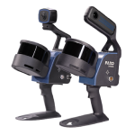
Unlock the full potential of 3D data capture with a powerful all-in-one solution built for speed, accuracy, and seamless on-site performance. The FARO® Focus, by FARO, redefines efficiency with Hybrid Reality Capture™, supercharged by cutting-edge Flash Technology™—delivering faster, better data like never before. But capturing great data is just the beginning. A truly complete solution goes beyond the scan.
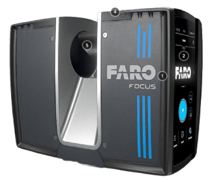
Whether you’re scanning bustling city streets or remote, rugged terrain, the FARO® Focus delivers exceptionally accurate 3D representations of any object or environment — even in the most extreme conditions. Get real-time, pre-registered feedback on-site through the intuitive FARO Stream™ App, empowering you to make faster, smarter decisions while still in the field.
Seamlessly transfer point cloud data to the FARO Sphere® XG Digital Reality Platform via Stream for instant collaboration, smoother workflows with third-party tools, and broader access for key stakeholders. With intuitive hardware and versatile software, FARO Focus is the all-in-one solution trusted by reality capture professionals worldwide.
FARO Focus Premium Max
Built for geospatial excellence, the Premium Max boasts an extended 400-meter range and 3D accuracy of up to 2mm. Designed for demanding applications, it comes fully equipped with a perpetual license to FARO Stream and Flash, a PanoCam Mount, and a 2-year manufacturer warranty — everything you need for high-performance capture right out of the box.
FARO Focus Premium
Perfectly suited for architecture, engineering, and construction, the Premium offers a 200-meter scanning range and precise 2mm accuracy. It includes a 1-year optional subscription to FARO Flash, a perpetual FARO Stream license, and a standard 2-year warranty, making it a versatile choice for professionals.
FARO Focus Core
Engineered for public safety and general operations, the Core delivers reliable performance with a 100-meter range and 2mm accuracy. With an optional 1-year FARO Flash license, a perpetual Stream license, and a 2-year warranty, it’s the dependable choice for a wide range of workflows.
FARO® Focus Performance: Speed Meets Precision
- Hybrid Reality Capture™
FARO is redefining field efficiency with Hybrid Reality Capture™, fueled by the groundbreaking Flash Technology™. Capture crystal-clear scans over 50% faster than traditional methods — with predictable, precise results on every job, from complex infrastructure projects to high-stakes forensic investigations. - Smarter Scanning, Seamless Sync
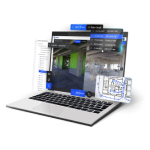
With Sphere XG, you’re not limited to a single device or dataset. This user-friendly ecosystem brings together point clouds from multiple FARO devices, delivering full visibility of your scanned environment. Whether you’re comparing scans over time, monitoring progress, or spotting potential issues early, Sphere XG turns raw data into actionable insights — and keeps your team, clients, and stakeholders in sync. - Ready for Your Workflow
Exporting point cloud data into your favorite tools is effortless, with compatibility for third-party software like Autodesk® ReCap™. FARO ensures your scans fit seamlessly into existing workflows. - Vibrant Detail, Stunning Accuracy
Capture every nuance in vivid detail with up to 266-megapixel color resolution — thanks to FARO’s advanced color technology. (Note: PanoCam required for Flash-enabled scans.)
FARO Focus Features: Engineered for Excellence
- Cut Scanning Time in Half
Powered by Flash Technology™, Hybrid Reality Capture™ delivers results over 50% faster than traditional scanning — without sacrificing accuracy. - Extended Range, Greater Coverage
Scan up to 400 meters, covering more ground per scan. Ideal for geospatial tasks like topographic surveys, boundary mapping, and large-scale infrastructure projects. - No More Blind Spots
Visualize your scans in real time with pre-registered feedback via the FARO Stream App — spot missing data or scan errors on-site and take corrective action immediately. - Instant Uploads, Smoother Collaboration
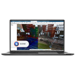
Share your data directly to Sphere XG for faster decision-making, or process offline using FARO SCENE Software for full control and flexibility. - Total Scan Control
Manage every setting via the Stream App or directly on the scanner’s intuitive touchscreen: adjust resolution, switch scan modes (color or B&W), group scans, annotate, and more. - Built for Tough Environments
Rugged construction with an IP54 rating means the Focus thrives even in harsh field conditions — day in, day out. - Fast, High-Capacity Storage
With a built-in 512GB SSD, enjoy maximum scan capacity and ultra-fast data processing right at your fingertips.
Features
Below, you will find the main features of the product.
Accelerate Capture
Integrated across all FARO Focus models, Flash Technology™ boosts data capture speed by over 50%, making frequent on-site updates easy and efficient. The result? Projects stay aligned with plans, errors are caught earlier, and costly rework or material waste is reduced.
Secure, Flexible Data Handling
Alongside seamless cloud-based sharing, FARO ensures data safety with offline processing in FARO SCENE. Each scanner includes a built-in 512GB SSD, storing data securely on the device and giving you peace of mind — even in remote or unpredictable environments.
Versatile Scanning for Any Site
From sprawling construction zones to confined public safety scenes, FARO Focus adapts to every project. With its extended range and rapid scan speed, it delivers reliable results for both large outdoor spaces and smaller, detail-critical environments.
Faster Scans, Smarter Decisions
Choose from 100m, 200m, or 400m scan ranges and capture data in real time using pre-registered feedback via the Stream App. Fewer setups, fewer errors, and faster in-field decisions lead to maximum productivity and higher-quality deliverables.
Powerful Processing in FARO SCENE
Handle large-scale projects with ease using the interactive registration tool in FARO SCENE. Efficiently process 1,000+ scans, mix registration types, and enjoy simple georeferencing — all without requiring expert input or complex workflows.
Connected Teams, Informed Action
Upgrade to the Sphere XG Digital Reality Platform for streamlined collaboration. Instantly upload data via the FARO Stream App, keeping all stakeholders connected, aligned, and ready to make faster, better-informed decisions from anywhere.
Applications
Discover the applications in which the product can be used.
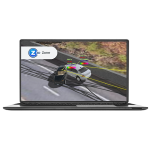
Crash Reconstruction
Crime Scene Investigation
Pre-incident Planning
Improved Quality Control and Inspection
Surveying and Mapping
Fast, Accurate Data Capture for Planning
Enhanced Design & Engineering
Improved Construction Quality Control
Efficient Production, Fabrication, and Assembly
Mine Surveying
Forestry Applications
Testimonials
Read what our satisfied customers have to say.
Related Products
See related products from this manufacturer
Get a Quote
You can fill out the contact form below and one of our representatives will contact you shortly.


