


RealityCapture
Create realistic 3D models from photos
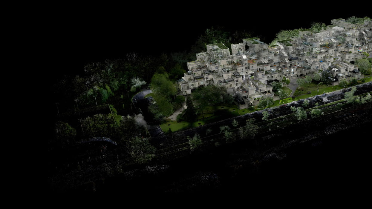
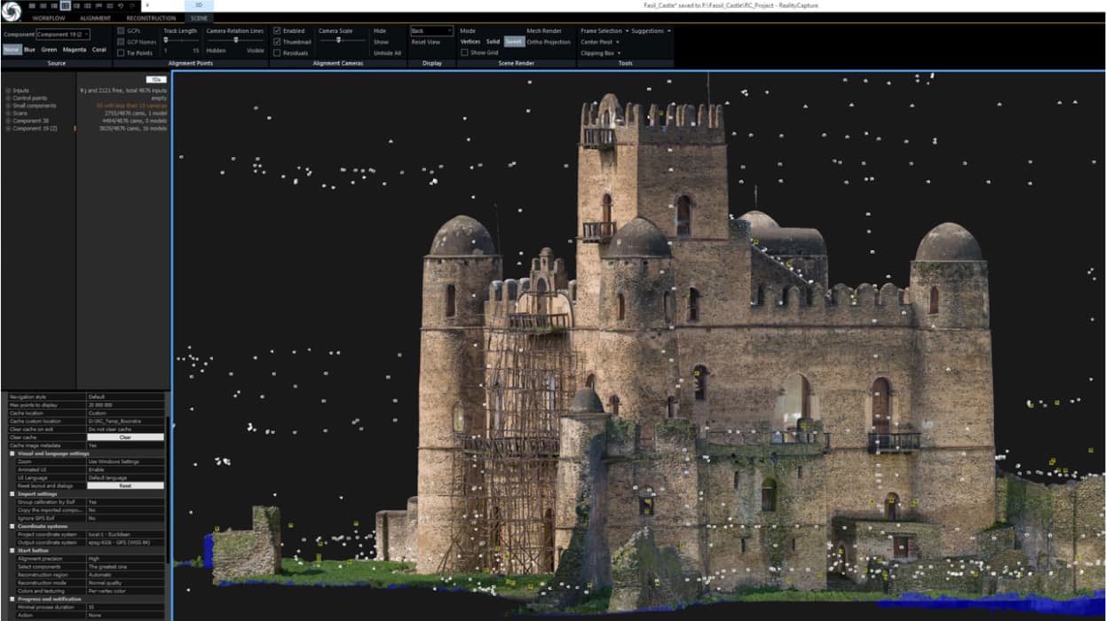
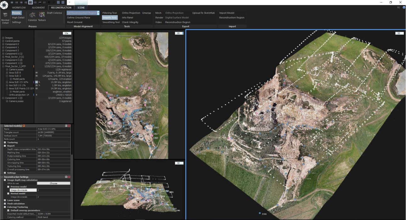
State-of-the-art all-in-one photogrammetry software solution which automatically extracts beautiful and accurate 3D models from a set of ordinary images and / or laser-scans. RealityCapture is a fully featured application with a rich easy-to-use UI, extremely fast state-of-the-art core and with a set of unique features which pushes the envelope of what can be done with the photogrammetric methods.
RealityCapture is a general-purpose fully-featured photogrammetry software for creating virtual reality scenes, textured 3D meshes, orthographic projections and much more from images and/or laser scans completely automatically.
Photogrammetry software application for Windows, which enables you to create ultra-realistic 3D models from a set of images and/or laser scans. Truly amazing speed, quality and accuracy with low demand on computer hardware. Registering images, calculating a mesh, a texture, parallel projections, DSM, geo-referencing and coordinate system conversion – that is just a fraction of what you get with RC.
RealityCapture is the state-of-the-art photogrammetry software solution that is changing the industry. It is currently the fastest solution on the market, which brings effectivity to your work and allows you to focus on your targets.
Create virtual reality scenes, textured 3D meshes, orthographic projections, geo-referenced maps and much more from images and/or laser scans completely automatically.
| Technical Specifications | |
|---|---|
| Photo & Video Processing | Import Photos/Video |
| Laser Scanning | Import Laser Scans |
| Data Fusion | Merging Photos with Laser Scans |
| 3D Model Generation | Triangular Watertight Meshes |
| Mesh Customization | Importing of Custom Meshes and UV Maps |
| Texture Processing | Coloring/Texturing |
| Surface Details | Normal and Displacement Maps |
| Texture Optimization | Re-projecting Textures from High Poly to Low Poly Model |
| Georeferencing | Control Points and Geo-referencing |
| Automation | Automatic Markers Detection |
| Mapping & Projection | Ortho-projections/Mapping |
| Terrain Analysis | Generation of DSM/DTM |
| Measurement Tools | Distance, Area, and Volume Measurements |
| Advanced Usage | Command Line Interface |
Related Products
See related products from this manufacturer
Get a Quote
You can fill out the contact form below and one of our representatives will contact you shortly.