


Trimble FieldLink Software
Construction Layout & Scanning Software
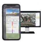
Trimble FieldLink is field layout and scanning software, by Trimble Geospatial, that gives you the power to increase precision and productivity in the field. Trimble FieldLink transitions across all Trimble layout and scanning instruments to help contractors translate the precision of 3D models directly into the field.
Trimble FieldLink provides your team with a flexible, scalable field layout and scanning solution that performs 200% better than traditional workflows.
- Boost productivity
Trust your crews to perform quality, automated layout with easy-to-use, task-based workflows, customizable views and a touch-screen interface. - Reduce errors and rework
Empower your teams with a combination of tools built just for contractors—increasing accuracy and avoiding the reintroduction of clash issues. - Easily translate design intent
Connect field crews to digital, 3D Constructible models to maintain a direct link between design intent and construction reality. - Leverage subscription plan flexibility
With affordable software license offerings positioned to suit your workflow, upgrades are immediately available to utilize the latest enhancements, and easily expand as you need to. - Streamline license management
Assign users, easily transfer between devices and generate usage reports to optimize your licenses, with a unique Trimble ID for each seat.
One solution for all field layout and scanning tasks
- Easy as-built collection
Quickly and easily collect as-built points with FieldLink and the Trimble Ri or Trimble RTS series Robotic Total Stations. Ensure accuracy with your model in real time. - Accurate layout, every time
Take control of robotic total station or GNSS receiver to precisely layout directly from the model or created lines. - Quick and efficient scans
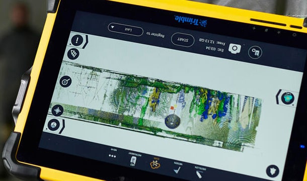
Quickly and effectively collect points, lines and curves to create your own 3D project as-built or surface analysis. - In-field 3D scanning registration
Leave the jobsite with a registered point cloud aligned to your Constructible model and easily export to your preferred CAD program.
Features
Below, you will find the main features of the product.
In-field 3D scanning registration
Leave the jobsite with a registered point cloud aligned to your Constructible model and easily export to your preferred CAD program.
Accurate layout, every time
Take control of robotic total station or GNSS receiver to precisely layout directly from the model or created lines.
Quick and efficient scans
Quickly and effectively collect points, lines and curves to create your own 3D project as-built or surface analysis.
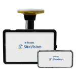
Related Products
See related products from this manufacturer
Get a Quote
You can fill out the contact form below and one of our representatives will contact you shortly.