


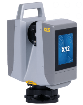
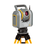
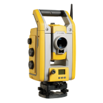
Trimble X12
Enhance your perspective.
The Trimble® X12 3D laser scanning system by Trimble unites the best of both worlds with industry-leading hardware and ultra-efficient Trimble Perspective software for guaranteed peak performance.
No more complicated workflows. No complex registration process. No compromises. High-end laser scanning with exceptional scanning speed and range combined with laser-focused accuracy and imagery is more accessible with the easy to use Trimble X12.
Confidence that the job is done right:
Top notch-performance equals confidence in precise data capture with the superior speed, accuracy and range of the X12.
Streamlined, accessible workflows:
Trimble Perspective provides in-field registration to refine data in the field and enables peak performance back to the office thanks to seamless workflows.
Enhance your perspective. With the Trimble X12 scanning system unparalleled ease of use, increased efficiency, exceptional quality of point clouds and imagery, are now more accessible than ever.
- Accessible:
Reduces complexities normally associated with high end scanning with unparalleled ease of use. - Productive:
Improves business efficiencies by offering the best scanner and software available to collect superior scan data and imagery faster than ever. - Dependable:
Top notch performance and technological advancements gives the confidence that you are getting the job done right.
Call us on +30 210 8023917 for more information.
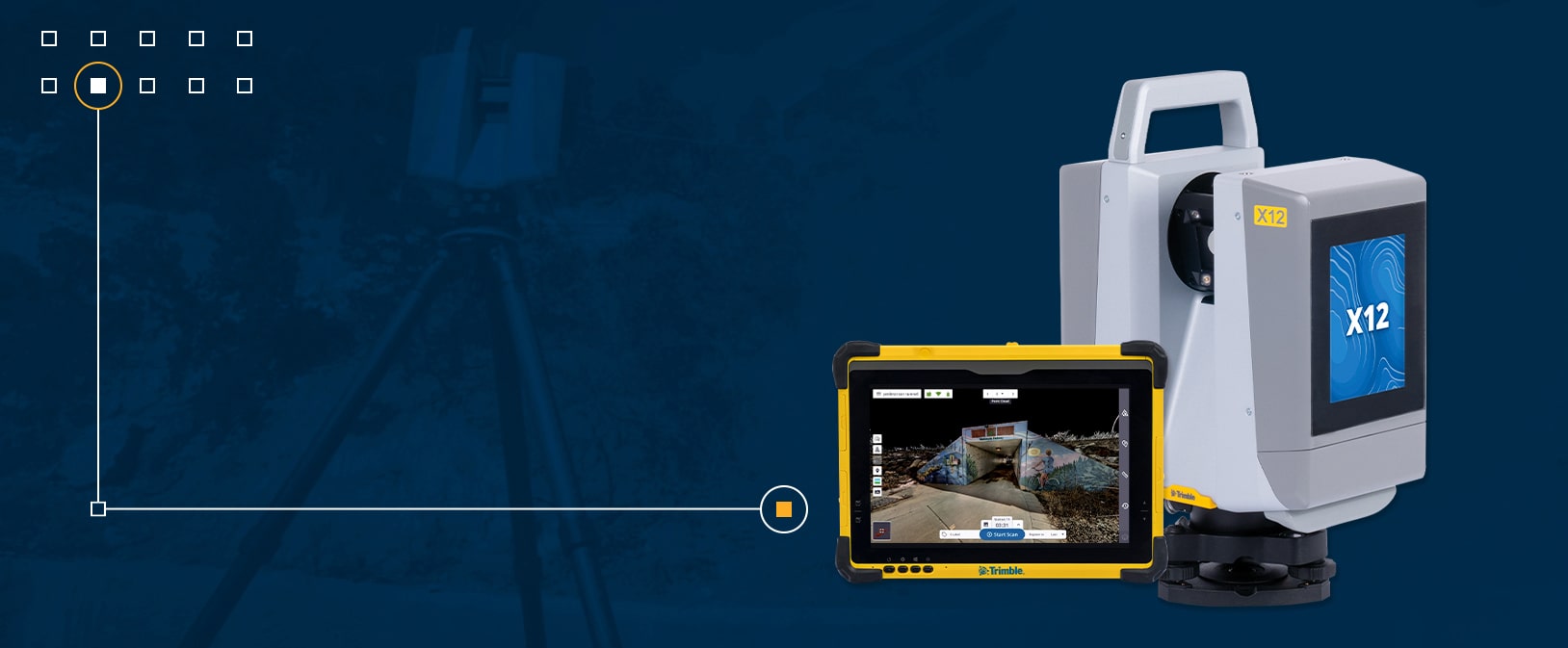
The Trimble X12 3D laser scanner combines stunning speed, accuracy, range, and image clarity in one easy-to-use package. Trimble X12 accessible high-end 3D laser scanning system, offers:
- High resolution point clouds:
Up to 2.187 million pts per second - Superior scan range:
0.3 m to 365 m ambiguity interval - Quick, flexible point cloud capture:
Full dome scans as fast as 23 seconds - Sharp, clean image acquisition:
Colorized point clouds, parallax free - Ease of use:
Intuitive Trimble Perspective workflows - LED spotlight:
Easy capture in dark environments
High resolution, accurate point cloud data
- Scan up to an astonishing 2.18 million points per second with a range of 365 meters.
- Range noise of 0.2 mm and density of 0.6 mm at 10 meters.
Quick, flexible point cloud capture
- Full dome scans as fast as 23 seconds, complemented with the ability to quickly and efficiently scan areas of interest at high quality settings.
- A minimum scan range of 0.3 meters, allowing you to capture more detail in tight spaces.
Sharp, clean image acquisition
- Experience breathtaking colorization of your point cloud data with parallax free images.
- Smart light, LED spotlights of 700 lumen improve image acquisition in poor light conditions and even completely dark environments.
Unparalleled Ease of Use
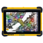
- Automatic in-field registration, refinement, reports and exports with Trimble Perspective on the T10x tablet.
- Comprehensive and user friendly OnBoard interface.
Features
Below, you will find the main features of the product.
Superior data quality
Exceptional accuracy, range and speed to quickly capture high density data with low range noise for the most complex applications.
Incomparable image acquisition
Sharp, parallax free images for flawless panoramas and scan colorization, plus LED spotlights to capture images even in complete darkness.
Intuitive & powerful
Trimble Perspective provides unparalleled clarity in the field with automatic scan registration and full 3D visibility to validate data in real time.
Complete scanning solution
With Trimble Business Center or RealWorks software, leverage advanced application specific tools for registration, scan analysis and design to enhance final deliverables.
Varied Applications
Trimble transforms data into real-world intelligence using the most progressive, reliable and accurate precision technology to meet needs of varied applications.
The future of your work
Trimble facilitates high quality, productive workflows and data exchange, driving value for a global, diverse user base.
Applications
Discover the applications in which the product can be used.
Topographic/General Surveys
Civil Infrastructure
Cultural Heritage
Industrial Survey
Multimedia
Below you will find all available multimedia, including videos & images.
Related Products
See related products from this manufacturer
Get a Quote
You can fill out the contact form below and one of our representatives will contact you shortly.