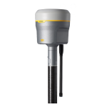
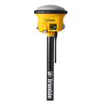
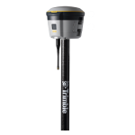
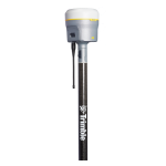
Trimble R2
Accuracy. Versatility. Flexibility.
The Trimble R2 GNSS system, by Trimble, is a compact, durable, flexible and easy-to-use GNSS receiver for GIS and survey professionals. Collect highly-accurate data in a wide range of geospatial applications with submeter to centimeter positioning accuracy.
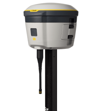
The Trimble® R2 is a compact, durable GNSS receiver that provides an easy-to-use solution for GIS and survey professionals who need to collect highly accurate data in a wide range of geospatial applications.
Capable of delivering between submeter and centimeter positioning accuracy in real-time to any mobile device via a wireless Bluetooth® connection, the R2 receiver gives you total flexibility to choose a solution based on the accuracy and GNSS performance level that suits your application, letting you work the way you want.
- Professional solution for GIS & survey applications ranging from submeter to centimeter accuracies
- Easily collect data by pairing with devices such as smartphones, tablets or Trimble handhelds
- Fast to setup, easy-to-use, keeping you productive and focused on your work
- Supports multiple satellite constellations and correction sources for accurate data at any location
- Compact, cable-free design with integrated antenna
Contact us for all available Trimble R2 solutions at +30 210 8023917 or via email at info@jgc.gr
This versatile, rugged GNSS receiver is perfect for a variety of GIS and surveying needs. The Trimble R2 with data accuracy, versatility in the field and flexible workflows, offers:
- 10 mm H/20 mm V:
Max. Precision - 220:
GNSS Channels - IP65/MIL-STD:
Ruggedness - Receive only – 450 MHz:
UHF radio - Integrated:
Antenna - iOS, Android, Windows 10:
Platform support
Features
Below, you will find the main features of the product.
Choose correction sources
Get higher accuracy in real time. Select correction sources from RTK, VRS networks or Trimble RTX™ correction services by satellite and internet/cellular.
Work how you want
Choose accuracy levels ranging from submeter to centimeter and select GNSS performance level to support any GIS or survey-grade workflow.
Multiple ways to pair & mount
Pair with a smartphone, tablet or Trimble handheld or controller running Trimble Access™ and Trimble TerraFlex®. Operate on a survey pole, backpack or vehicle.
Simple to operate in the field
Its one button start-up and compact, cable-free design means R2 is fast to set up and easy to use, keeping you productive and focused on your task at hand.
Varied Applications
Trimble transforms data into real-world intelligence using the most progressive, reliable and accurate precision technology to meet needs of varied applications.
The future of your work
Trimble facilitates high quality, productive workflows and data exchange, driving value for a global, diverse user base.
Multimedia
Below you will find all available multimedia, including videos & images.
Related Products
See related products from this manufacturer
Get a Quote
You can fill out the contact form below and one of our representatives will contact you shortly.


