Trimble Catalyst
Software GNSS. Seriously.
Trimble Catalyst by Trimble, is a GNSS positioning service that delivers high-quality positioning for the Trimble DA2 GNSS receiver. Choose your precision level, purchase your subscription and connect a DA2 to map, navigate and measure using any location-enabled app.
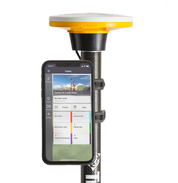
Trimble Catalyst makes your data capture workflows simply precise. Catalyst is a revolutionary software-based GNSS technology receiver solution from Trimble.
Many times the tracking needs in the field require a higher accuracy than that produced in the internal GNSS receiver of a mobile smartphone or tablet. However, these applications are not as frequent as we would like and at the same time we do not want to maximize the initial cost of purchasing a receiver.
Simple, flexible and effortless:
It’s never been easier to map assets at the accuracy level required, letting you work from a location-enabled app on your own Android or iOS device.
The benefit of subscription GNSS:
Low upfront cost for hardware and subscription for positioning. Now you can offset the costs for GNSS positioning against your projects.
Contact us for all available Trimble Catalyst and DA2 receiver solutions on +30 210 8023917 or via email at info@jgc.gr.
How it works: Trimble transformed Trimble core GNSS technology into an easy-to-use service. Simply select a plan to get on-demand precision on your mobile device.
- Choose your precision:
Pick the precision level to suit your needs. - Purchase a subscription:
All-in-one GNSS performance and corrections. - Connect a DA2 receiver:
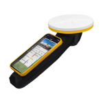
Wirelessly connect a DA2 receiver to your phone, launch your app, sign in to Catalyst, and go!
Trimble Catalyst subscription-based GNSS positioning service, offers:
- Platform compatibility:
iOS and Android - Choice of accuracy levels:
From sub-meter to centimeter - Usage plans:
Hourly, monthly or annual - Real-time Trimble corrections:
Included in your subscription - Lightweight, low-cost DA2 receiver:
Survey-quality RTK positions - Works with your apps:
Supports any location-enabled app
Features
Below, you will find the main features of the product.
Trimble DA2
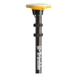
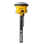
The engine at the heart of the Catalyst positioning service, the DA2 receiver delivers survey-quality positioning to location-enabled Android or iOS apps.
Choose your accuracy level
From survey-grade centimeter to sub-meter positioning, choose the Catalyst subscription with the accuracy level that best suits your business.
Choose your term
Pay per hour, per month or per year—whatever suits your business best. Top up lower accuracy levels with centimeter precision on-demand by the hour.
Trimble Corrections Hub (TCH)
TCH is included with your Catalyst subscription and provides configuration-free access to real-time corrections data around the world, working online or offline.
Varied Applications
Trimble transforms data into real-world intelligence using the most progressive, reliable and accurate precision technology to meet needs of varied applications.
The future of your work
Trimble facilitates high quality, productive workflows and data exchange, driving value for a global, diverse user base.
Applications
Discover the applications in which the product can be used.
GIS Mapping & Data Collection
GNSS Land Surveying
Mobile GIS Applications
Land & Cadastral management
Utilities and Public Administration
UAV
Multimedia
Below you will find all available multimedia, including videos & images.
Related Products
See related products from this manufacturer
Get a Quote
You can fill out the contact form below and one of our representatives will contact you shortly.


