





DJI Zenmuse L3
Long-Range Aerial LiDAR System
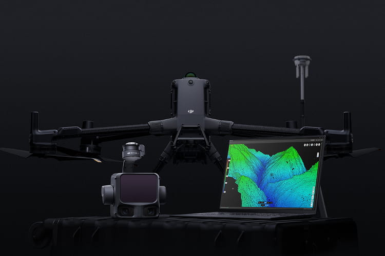
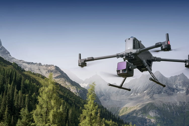
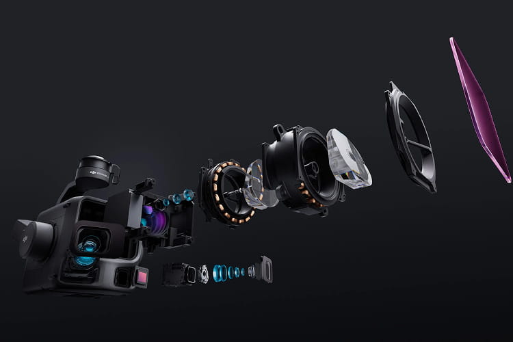
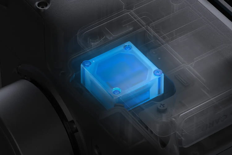
Zenmuse L3, by DJI, is DJI’s first long-range, high-accuracy aerial LiDAR system. A 1535nm LiDAR, dual 100MP RGB mapping cameras and a high-precision POS system share one three-axis gimbal on the DJI Matrice 400, capturing survey-grade point clouds and imagery over large areas.

One Workflow, From Flight to Deliverable
Zenmuse L3 runs within DJI’s own ecosystem: the D-RTK 3 Multifunctional Station for positioning, DJI Pilot 2 for flight, DJI Terra for processing, DJI Modify for editing and DJI FlightHub 2 for cloud management. Teams complete the whole project on one platform instead of moving data between separate tools.
Plan and Check in the Field
DJI Pilot 2 plans Waypoint, Area and Linear routes. During the flight, a real-time point cloud preview and built-in measurement tools let operators confirm coverage before leaving the site. The preview is for field checks only, and final high-accuracy results are produced in DJI Terra.
Centimeter-Level Positioning
With the D-RTK 3 set up as a base station, flight data can be post-processed (PPK) for maximum accuracy. For best results, keep the station within 15 km of the aircraft and tracking more than two GNSS constellations. Data from third-party base stations is also supported.
Processing in DJI Terra
DJI Terra (V5.1.0 or later) handles point cloud reconstruction, LiDAR calibration and PPK, and point cloud processing is free. Results export to standard formats for GIS, CAD and BIM software, and DJI Modify imports LAS files for further editing.
What You Need
Zenmuse L3 is compatible only with the DJI Matrice 400 and mounts on its E1 port through the Zenmuse L3 single gimbal connector. Use the bundled 1 TB CFexpress Type B card: other cards can drop frames and reduce accuracy, and DJI Pilot 2 shows a warning when one is inserted.
| General | |
|---|---|
| Weight | 1.60 kg (single gimbal connector: 145 g) |
| Dimensions (L×W×H) | 192 × 162 × 202 mm |
| Power | 64 W typical, 100 W max |
| Supported Aircraft | DJI Matrice 400 (with single gimbal connector) |
| Ingress Protection | IP54 |
| Operating Temperature | -20° to 50° C |
| Storage Temperature | -40° to 70° C |
| Point Cloud Accuracy (RMSE) | 120 m: 3 cm vertical, 4 cm horizontal 300 m: 5 cm vertical, 7.5 cm horizontal |
| Point Cloud Thickness (1σ) | 1.2 cm @ 120 m, 2 cm @ 300 m |
| Combined Horizontal FOV | 107° (dual RGB cameras) |
| RGB GSD | 3 cm @ 300 m |
| LiDAR | |
|---|---|
| Laser Wavelength | 1535 nm |
| Detection Range | 700 m @ 10% reflectivity, 350 kHz 950 m @ 10% reflectivity, 100 kHz 2,000 m @ 80% reflectivity, 100 kHz (default max. 900 m) |
| Wire Detection (100 klx, 350 kHz) | 21.6 mm steel-core aluminium stranded wire: 300 m 18.4 mm black PVC-insulated wire: 100 m |
| Ranging Accuracy | ±10 mm absolute, <5 mm repeatability (1σ) |
| Minimum Detection Distance | 10 m |
| Pulse Frequency | 100 kHz (<500 m), 350 kHz (<300 m), 1,000 kHz (<100 m), 2,000 kHz (<50 m) |
| Number of Returns | Up to 16 (4/8/16 at 100 and 350 kHz, 4/8 at 1,000 kHz, 4 at 2,000 kHz) |
| Beam Divergence | 0.25 mrad (1/e²) |
| Laser Spot Size | Φ41 mm @ 120 m, Φ86 mm @ 300 m |
| Scanning Modes | Linear: 80° × 3° Star-Shaped: 80° × 80° Non-Repetitive: 80° × 80° |
| Laser Safety | Class 1 (IEC 60825-1:2014) |
| RGB Mapping Camera | |
|---|---|
| Sensor | 2 × 4/3 CMOS, 100 MP |
| Lens | 28 mm equivalent, f/2.0–f/11 |
| FOV (per camera) | 73.3° diagonal, 62° horizontal, 41.2° vertical |
| Mechanical Shutter | 2–1/2000 s (2–1/1500 s at f/2.0), 500,000 actuations |
| Electronic Shutter | 2–1/16000 s |
| Photo Size | 100 MP (12288 × 8192), 25 MP (6144 × 4096) |
| Minimum Photo Interval | JPEG: 0.5 s (25 MP), 1 s (100 MP) RAW / JPEG+RAW: 1.2 s |
| Video | 4K 3840 × 2160 @ 30fps, FHD 1920 × 1080 @ 30fps (MP4, H.265) |
| POS & Gimbal | |
|---|---|
| GNSS / POS Update Rate | 5 Hz / 200 Hz |
| Attitude Error (post-processed, 1σ) | Yaw 0.02°, pitch/roll 0.01° |
| Positioning Accuracy (RTK fix) | Horizontal 1 cm + 1 ppm, vertical 1.5 cm + 1 ppm |
| Supported PPK Formats | DAT, RINEX v2.1x/v3.0x, RTCM v3.0–v3.3 (MSM3–MSM7), OEM4, OEM6 |
| Gimbal | 3-axis, ±0.01° angular accuracy |
| Controllable Range | Pitch -120° to +60°, yaw -80° to +80° |
| Mount | Detachable DJI SKYPORT |
| Storage & Software | |
|---|---|
| Memory Card | CFexpress Type B (1500 MB/s sequential write) |
| Raw Data | Photo, IMU, point cloud, GNSS and calibration files |
| Data Collection | DJI Pilot 2 |
| Data Processing | DJI Terra |
| Data Application | DJI Modify |
| Cloud Application | DJI FlightHub 2 |
| Point Cloud Export (DJI Terra) | LAS, LAZ, PLY, PCD, PNTS, S3MB |
Features
Below, you will find the main features of the product.
1535nm Long-Range LiDAR
Detects objects with only 10% reflectivity at up to 950 m and emits up to 2 million points per second. An adjustable pulse rate lets you balance range against point density for each mission.
Dual 100MP Mapping Cameras
Two 4/3 CMOS sensors with mechanical shutters cover a combined 107° horizontal field of view and reach a 3 cm ground sample distance from 300 m, for sharp, distortion-free orthophotos.
Survey-Grade Accuracy
Vertical accuracy of 3 cm at 120 m and 5 cm at 300 m, with 5 mm ranging repeatability, meets 1:500 to 1:2000 mapping scales. A high-precision POS system georeferences every point.
Three Scanning Modes
Linear mode gives even point distribution for terrain mapping, Star-Shaped suits forests and dense urban areas, and Non-Repetitive captures transmission towers and other complex structures from multiple angles.
High Penetration
A 0.25 mrad beam produces a laser spot about one-fifth the size of the Zenmuse L2’s, and up to 16 returns per pulse capture more ground points beneath dense vegetation and between buildings.
Up to 100 km² per Day
On the Matrice 400, a single flight at 300 m covers up to 10 km². LiDAR and RGB are captured together, so orthophotos and elevation models come from one flight, even at 20% side overlap.
Applications
Discover the applications in which the product can be used.
Topographic Survey & Mapping
Power Line Inspection
Forestry
Related Products
See related products from this manufacturer
Get a Quote
You can fill out the contact form below and one of our representatives will contact you shortly.