


CloudStation
LiDAR processing software
CloudStation, by YellowScan, is a flexible and user-friendly LiDAR software, developed by YellowScan, for the creation and visualization of point-clouds. The software provides automatic lane detection, in-depth configuration and LAS file exports for interfacing with all your tools.
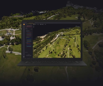
CloudStation’s powerful 3D engine allows you to effortlessly display billions of waypoints, measure distances and get information about your waypoints with one click.
Extract, edit, display and export LiDAR data immediately after a flight. Effortlessly handle multi-flight acquisitions in a single project. Narrow your trajectory easily with POSPac integration.
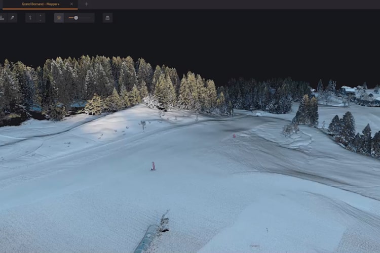
Gain a better understanding of the point cloud you are creating,
- Measure the attenuation
- Assess the quality of the terrain classification by checking the base of the vertical elements
- Check the mismatch between the flight lines by measuring the strip-to-strip distance
Designed to improve data and set high standards for the quality of your surveying projects.
Modify lanes or flight lines and improve the quality of your pointcloud.
- One-click settings
- Powerful algorithms used in fitting methods
- Use ground control points (GCP) for final adjustments
- Powerful algorithms used in fitting methods
- Use ground control points (GCP) for final adjustments
- Smooth adjustment of the stripes
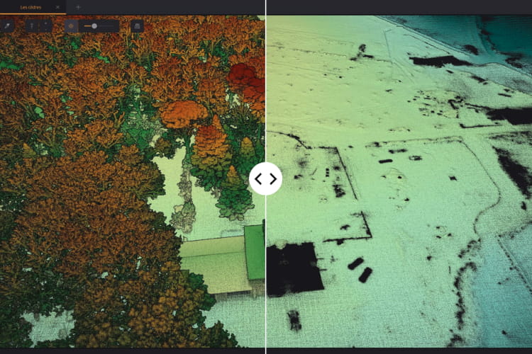
Extract 3D point clouds with classification
- Automatic classification of points as “ground/non-ground”
- Export Digital Model from your classified point cloud as GeoTIFF (geolocated TIFF): DSM, DTM, DHM.
- Export Rank .LAS
- Create hill shadow from your DTM
Extract color point clouds from simultaneous LiDAR + camera acquisition.
- Combine the data generated from your flight with photos taken to create a color pointcloud
- Color and visualize your strips
- Automatic calibration and improvement of the LiDAR camera
- Two coloring methods are available
- Designed for camera hardware
- Colorization from external orthophotos is available
Features
Below, you will find the main features of the product.
Explore the cloud spots
Discover sample data captured with YellowScan LiDAR systems, select a specific sensor and download the relevant dataset.
Expert guidance
CloudStation is available on an annual license plan with 1 year maintenance, including support and software updates.
10 years of LiDAR experience
YellowScan's R&D team strives to innovate, develop new features and improve CloudStation on a daily basis.
Related Products
See related products from this manufacturer
Get a Quote
You can fill out the contact form below and one of our representatives will contact you shortly.