TBC Aerial Photogrammetry
Elevated aerial survey workflows.
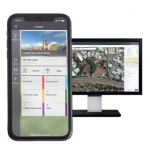
The Trimble Business Center – TBC Aerial Photogrammetry office software, by Trimble, seamlessly integrates aerial photogrammetry adjustments and deliverables with existing survey workflows and data processing features.
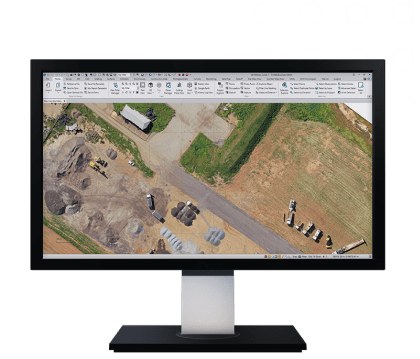
TBC Aerial Photogrammetry software streamlines the adjustment process and deliverable creation to maximize your UAV investment with tools that are applicable to many industries.
Take your UAV data further with TBC
Transform your UAV data into geo information using CAD, surface, corridor, point cloud classification and feature extraction, and scan inspection tools.
One software for many sensors
Ensure fidelity and save time by combining your UAV deliverables with GNSS, total station or digital level data, and terrestrial or mobile mapping scan data.
Trimble Business Center Aerial Photogrammetry that streamlined UAV workflows for surveyors, offers:
Existing condition maps:
Create accurate surface modelsAs-built topography:
Document interim & final stagesPrecise volume & quantities:
Report earthwork computationsRobust inspections:
Compute & compare to model objectsDetect site changes:
Monitor progress visuallyClearances & distances:
Measure to make timely decisions
Features
Below, you will find the main features of the product.
A workflow for any drone
Leverage your production with a comprehensive camera library of all the industry-leading brands or you can flexibly add your new UAV to the library.
Three-step processing
Import, adjust, and create with straightforward steps that balance intuitive options with the quality of the underlying photogrammetric adjustment.
Faster than competitors
Reduce processing time without compromising the quality of deliverables—TBC is 25% more efficient than competitors at equivalent settings.
High accuracy results
Create denser, survey-grade point clouds and orthophotos with sharper edges, higher contrast and better color balance than other photogrammetric software.
Varied Applications
Trimble transforms data into real-world intelligence using the most progressive, reliable and accurate precision technology to meet needs of varied applications.
The future of your work
Trimble facilitates high quality, productive workflows and data exchange, driving value for a global, diverse user base.
Multimedia
Below you will find all available multimedia, including videos & images.
Related Products
See related products from this manufacturer
Get a Quote
You can fill out the contact form below and one of our representatives will contact you shortly.