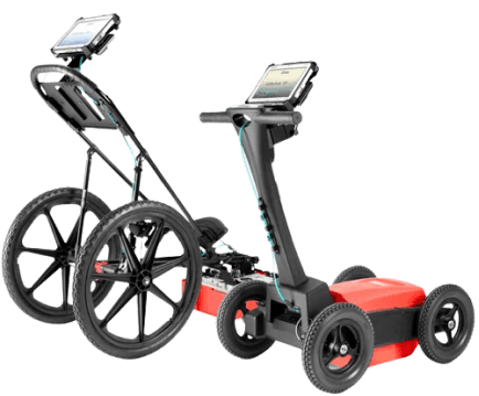
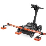
The UtilityScan DF incorporates the innovative dual-frequency (300 and 800 MHz) digital antenna and an easy-to-use touch screen to view shallow and deep targets simultaneously, in a single scan. Operating depth up to 7 m. 128GB storage capacity.
Blend Mode
Data illustrates several metallic and non-metallic targets at various depths in blend mode. Green shaded area represents estimated signal floor. Red/blue dotted line identifies the soil velocity calculation tool.
3D Mode
Data illustrates three metallic targets at depths of 1, 2 and 3 feet collected at GSSI’s utility test pit using 3D mode.
Typical uses of UtilityScan DF include:
- Detection of underground networks
- Environmental impact assessment
- Damage prevention
- Geological survey
- Archeology
- Forensics
- Road inspection
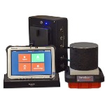
System Includes:
- 300/800 MHz DF antenna
- Panasonic G1
- Toughbook
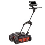
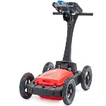
- Choice of 2-wheel or 4-wheel cart
- 2m digital control cable
- Transit case
- Lithium-ion battery (2)
- Dual-bay battery charger
- 2-year warranty