RoadScan 30
Complete GPR System for Road Inspection
The RoadScan 30 system, by GSSI, provides users with an effective tool for quickly determining pavement layers at high speeds. RoadScan is able to collect data densities not obtainable using other labor-intensive methods commonly used for pavement testing.
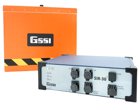
The RoadScan system by GSSI is a cutting-edge solution for road inspection and analysis, equipped with the powerful SIR 30 Control Unit. It includes a high-frequency 1 or 2 GHz horn antenna for precise subsurface imaging, along with a wheel-mounted distance measuring instrument (DMI) for accurate data collection.
The system comes with a 7-meter control cable for flexibility in operation, a reliable power supply, and a durable transit case for safe transport of the SIR 30 unit. Backed by a 2-year warranty, RoadScan ensures long-lasting performance, making it an ideal choice for professionals in road condition assessment and maintenance.
The RoadScan 30 is typically used to,
- NDT road evaluation
- Measure pavement thickness
- Evaluate base and sub-base conditions
- Measure asphalt prior to milling operations
- Determine areas to core
| Technical Characteristics | |
|---|---|
| System | SIR 30 |
| Antenna Support | Compatible with all GSSI analog antennas |
| Number of Channels | Records data from 1 to 4 hardware channels simultaneously; two 4 channel systems can be connected to form an 8 channel system |
| Data Storage | Internal memory: 900 GB, GPS data logged internally |
| Display Modes | Linescan and O-scope. In Linescan display, 256 color bins are used to represent the amplitude and polarity of the signal |
| Operational Modes | External laptop, standalone with external monitor and keyboard, or remote command set |
| Max Depth | 91 cm (3 ft) |
| Antenna Options / Antenna Frequency | 2 GHz, 1 GHz |
| Weight | 49.8 kg (110 lbs) |
| Optional Software | RADAN 7, RADAN 7 RoadScan Module |
| Accessories | Antenna vehicle front mount, Antenna vehicle trailer mount |
Features
Below, you will find the main features of the product.
Non-destructive Pavement Testing
The RoadScan can quickly collect pavement layer thickness data. The system acquires data at highway speeds, which eliminates the need for lane closures and provides a safer working environment.
Deliver Pavement Evaluation Results
Data can be easily exported as ASCII output files for simple data transfer to other software programs. Or migrate data results as Google Earth™. kml file for enhanced visualization.
Quick and effective road analysis surveys
Determine pavement layer thickness and evaluate base and sub-base layers with limited, to no need, of coring required.
Multimedia
Below you will find all available multimedia, including videos & images.
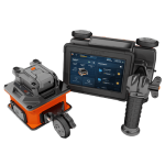
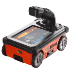
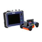
Related Products
See related products from this manufacturer

Get a Quote
You can fill out the contact form below and one of our representatives will contact you shortly.